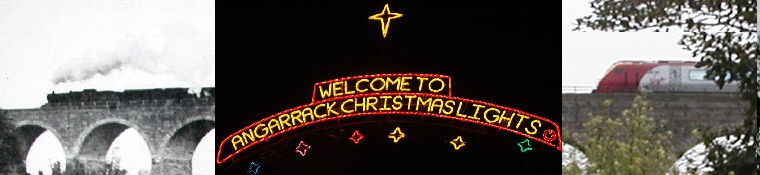
Angarrack viaduct
Submitted by Angarrack.info ... on Fri, 01/02/2013 - 01:00.
Via Wikipedia
Angarrack viaduct
From Wikipedia, the free encyclopediaCoordinates: 50.19331°N 5.38516°W
 Angarrack viaduct and the village below in March 2010
Angarrack railway viaduct is situated at Angarrack in west Cornwall, United Kingdom.[1]
The eleven-arch granite-built viaduct [2] carries the Cornish Main Line railway across the steep-sided valley of the Angarrack River, a tributary of the River Hayle, between the present day stations of Camborne and Hayle.[1] The village extends up the valley and under the viaduct.
The original viaduct at Angarrack was designed by Isambard Kingdom Brunel for the west Cornwall Railway and was "... built wholly of timber on stone footings".[2] It was nearly 800 feet (240 m) long and 100 feet (30 m) high. The present viaduct of roughly the same dimensions was an entirely new replacement structure and opened by the Great Western Railway in 1885. Its eleven stone arches each have a span of 56.5 feet (17.2 m).
The stone from the original Brunel footings was re-used to construct the sea wall on the approach to Penzance railway station. Today, no evidence remains of Brunel's original structure.[2]
References
- ^ a b Land's End. Landranger. 203. Southampton: Ordnance Survey. ISBN 978-0-319-23148-7.
- ^ a b c Binding, John (1993). Brunel's Cornish Viaducts. Penryn: Atlantic Transport Publishing/Historical Model Railway Society. pp. 106–107. ISBN 0-906899-56-7.
See also

Angarrack
The Hayle Railway introduced passenger trains on 23 May 1843. The service was closed on 16 February 1852. On 11 March 1852 the West Cornwall Railway opened a new station. The old station had been on the section of the Hayle Railway that was closed entirely as a steep rope-worked incline descended from Angarrack to sea level at Copperhouse, it was replaced by a much gentler incline to the new Hayle railway station. However the new Angarrack station was closed in 1853. (See also Angarrack viaduct.)
Contributions
- Angarrack Defibrillator Team (25)
- Angarrack Inn (336)
- Angarrack Methodist Chapel (3)
- AngarrackSanta (2)
- Carol (15)
- Gail (1)
- GordonG (12)
- Hayle Development Group on Facebook (5)
- Hayle Harbour Authority (4)
- Hayle Town Council (5)
- louise (1)
- Lynne (111)
- Mal (1)
- MattBuckley66 (9)
- Neil (22)
- Neils Garden Care (9)
- Russell (21)
- Secretary - Christmas Lights (145)
- Steve (3)
- webmaster (5127)
Book page
Similar
- 1852 | Angarrack 29 July 1852 Brunel ENGINEER’S REPORT West Cornwall Railway Company
- 1852 | Completion of the Cornwall Railway | West Briton 5 March 1852
- 1851 | Angarrack Viaduct - Timber Brunel
- 1883 | Angarrack Viaduct | Richard WHIDDON 15 22-Oct 1883 | Fell from a crane at Angarrack Viaduct
- 1884 | Angarrack Viaduct | Thomas BORE and Thomas WAKEHAM | 4-Jul 1884 | Killed at Angarrack Viaduct by a falling derrick
Similar across site
- 1852 | Angarrack 29 July 1852 Brunel ENGINEER’S REPORT West Cornwall Railway Company
- 1852 | Completion of the Cornwall Railway | West Briton 5 March 1852
- 1851 | Angarrack Viaduct - Timber Brunel
- 1883 | Angarrack Viaduct | Richard WHIDDON 15 22-Oct 1883 | Fell from a crane at Angarrack Viaduct
- 1884 | Angarrack Viaduct | Thomas BORE and Thomas WAKEHAM | 4-Jul 1884 | Killed at Angarrack Viaduct by a falling derrick


Recent comments
26 weeks 20 hours ago
31 weeks 22 hours ago
31 weeks 22 hours ago
46 weeks 20 hours ago
1 year 13 weeks ago
1 year 13 weeks ago
1 year 13 weeks ago
1 year 13 weeks ago
1 year 35 weeks ago
1 year 49 weeks ago